


GPS Tracks for Walking, Hiking and Cycling
The Links to the individual tracks will open up a new window with the relevant track on WIKILOCS. To download a specific track you must register (or log on, if you already have an account with WIKILOCS).
Disclaimer: We make no warranty with regard to the accuracy or safety of the published tracks and waypoints ("Locations"). For hiking we recommend to take additional local maps and to use proper equipment.
Find all walks/cycle tracks in Co.Clare >here
Cycling Tracks
- Around Quilty & Mullagh
Perfect track for a family day out. Beaches, Pubs and Shops well stocked with drinks and ice cream will keep your children happy. Mostly on quiet back roads. Bicycles for hire in Miltown Malbay. Length: 17,5 kms - Doonbeg Kilkee Ireland West Clare Loop on sideroads
Spectacular coastal and sea views. Track can also be joined from the Kilkee Side via the N67 or Waypoint "Intersection", from Kilkee add ~3kms to the track length.Length: 30 kms, 3 hrs. - Around Burren National Park
On this loop around Mullaghmore (Burren National Park) you'll encounter nearly everything what the Burren limestone landscape has to offer: megalithic tombs, ring forts, endless stone walls, hidden green valleys, flowers among bare rock, wild goats, viewpoints, hills & lakes. The route is mostly on small paved roads except for 4kms on a "Green Road", an old cattle track. There are still cattle around, so from autumn to spring this part can be a bit muddy. This track is also a great day hike (around 20kms, allow 6-8 hrs) if you take the "Famine Road" and follow the red markers across Mullaghmore Mountain ('Mullaghmore Traverse'). Length: 24 kms, 2 - 3 hrs. cycling, 6-8 hrs hiking - Scenic West Clare
Bicycle Loop including some of the most scenic backroads in Mid/West-Clare, Ireland. The beautiful views you'll encounter (weather permitting) reach from the Connemara Hills to the Kerry Mountains, from the Atlantic Coast to the Burren and East Clare. Route is (with the exception of 300 meters) on nearly traffic-free paved single lane country roads through woodlands, across scenic bogs and along hidden lakes through the rolling hills of West and Mid Clare. Limited parking, best places to start are across the Bogdale Pub in Kilmaley or from the Crosses of Annagh Pub near Miltown Malbay (adds ~5 kms to the route). The very scenic picnic area at Millenium park invites for a break. Bicycles for hire in Miltown Malbay and Ennis, Co.Clare. Length: 32,35 kms, at least 3 hrs, plus stops for Picnic and Sightseeing - Westclare Landscapes including Cahermurphy Woods
Easy-to-drive circuit to explore the Doonbeg Area. Mostly on quiet country lanes through Boglands and near the coast with views on Atlantic up to the Cliffs of Moher. Includes a visit to Doughmore Beach. Not suitable for racing bicycles! Length: 27.3 kms, 2.5-3.5 hrs. - Loop Head Circuit West Clare
Track around rugged Loop Head Peninsula along Coasts of Atlantic and the Shannon Estuary. Amazing Coastal scenery between Kilkee and Loop Head Lighthouse.Beaches and Picnic Areas on the Shannon Estuary with View to Dingle Peninsula. Routing includes all the major sights and does not coincide with Loop Head Drive nor Loop Head Cycleway! Quiet paved single lane roads throughout. Not recommended on a windy day! Length: 61.3 kms, at least half a day, plus stops for Picnic and Sightseeing - Around Doonbeg
Easy-to-drive circuit to explore the Doonbeg Area. Mostly on quiet country lanes through Boglands and near the coast with views on Atlantic up to the Cliffs of Moher. Includes a visit to Doughmore Beach. Not suitable for racing bicycles! Length: 25.2 kms, 2-3 hrs. - Kilfenora Burren
This track is a shorter, more family friendly version of north clare bicycle loop no.4 (originally from Doolin) but starts and ends in Kilfenora. Quiet roads, nice Burren scenery. Highlight is little visited Noughaval Church, one of the earliest christian monuments of the Burren. Lots of good parking opportunities in Kilfenora. Length: 23 kms, 2-3 hrs. - Mid Clare
Loop track in lovely landscape of Mid Clare, following in parts the walking route Mid Clare Way. Most of the route is paved, except for 1 km which follows a narrow foot path, where you might have to get off the bike. Starts and ends in Connolly, good parking opportunities at the church and at a convenience shop nearby. Length: 28 kms, 2-3 hrs.
Walking & Hiking Tracks
- Kilkee Cliffs Loop Walk
The cliffs of Kilkee are far less known, but not less impressive than the Cliffs of Moher... and no entrance fees, few people only, tranquility! Most people only walk the mile from Kilkee's West End up to the first cliff, but it's well worth to walk all the way along the coast. This is a suggested loop walk, but you can do it along the coast only, in both directions, take a short cut halfway - or cycle it. All is very rewarding. max. length 18.4 km, 4-5 hrs - Coastal Loop Walks Clare Ireland: Whitestrand to Blue Pool (near Doonbeg)
Coastal walks in Ireland usually involve the climbing of fences, the crossing of small streams, muddy portions, a bit of rock climbing and grim looking bulls standing in your way. This walk here is no different but you're rewarded with splendid wild coastal scenery and the chance of observing rare sea birds as well as dolphins and seals. Start your walk from the car park at White Strand beach, Caherlean, Doonbeg - one of the best beaches in Clare and rightly rewarded with the Blue Flag. Length 8.2 km, 2,5 - 3 hrs - Coastal Loop Walk: Bluepool to Horseshoe (Baltard Bay near Doonbeg/Kilkee)
Spectacular coastal track, one of the finest in Ireland. Fantastic cliff scenery, seabirds breeding, chance of observing dolphins. This walk can be combined with the track "Whitestrand to Blue Pool" (18km total, 6 hrs.) WARNING: Not to be walked in wet conditions nor with children. Along the edge of high cliffs, also involves climbing fences. In no case climb down the rocks to swim in the rock pools or for angling. Dangerous high waves rolling in regularly. Use extreme caution on this track and watch your steps! Trespassing private property, leave nothing but your footsteps and stay clear of cattle and horses. Length: 9.8 kms, 3 hrs. - Letteragh Forest Loop Mid Clare Way
Easy loop walk for the whole family, part of the rather quiet Mid Clare Walkway. This track winds mostly through forest, beautiful views on Clare countryside in between. Length 5.2 km, 1 hr - 1 hr 30 mins. - Coastal Loop Walks Clare Ireland: Seafield Quilty
A pleasant family walk along and around Seafield Beach - best to walk around Low Tide! Length 5,8 km, 1-2 hrs - Mullaghmore Loop Burren National Park
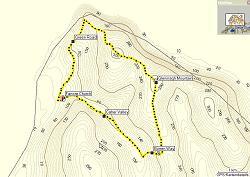
This difficult but very rewarding walk follows the blue marked trail on and around the mountain with the addition of an adventurous alternative. Though leading through some rough terrain you may expect unusual rock formations and fossils which you don't find anywhere else in the Burren. Use extreme caution on the whole track and watch your step. Finish the experience with a tea & scones in Father Ted's House, nearby. Length: 6.6 kms, 3 hrs. - Gleninagh Mountain, The Burren
A wonderful circuit to explore the limestone landscape of the Burren! Features splendid views on Galway Bay and ancient monuments. Starts at Fanore Church and can be done in both directions. Requires constant attention to avoid stepping into one of the numerous fissures! Length: 14.2 kms, 4-5 hrs. Download GPX Track here (1. Right click on "download" 2. Click on ("save linked content/target as...") 3. Download (depending on your browser it will either be saved as a .xml file or as a .gpx file) 4. Open the file with Mapsource , G7towin or similar programs to upload it to your navigational device.